Short term
Construction platform
- Unified design + scheduling + work-logs
- Full digitalization of water-and-sewer construction
- Field deployments + service stabilization

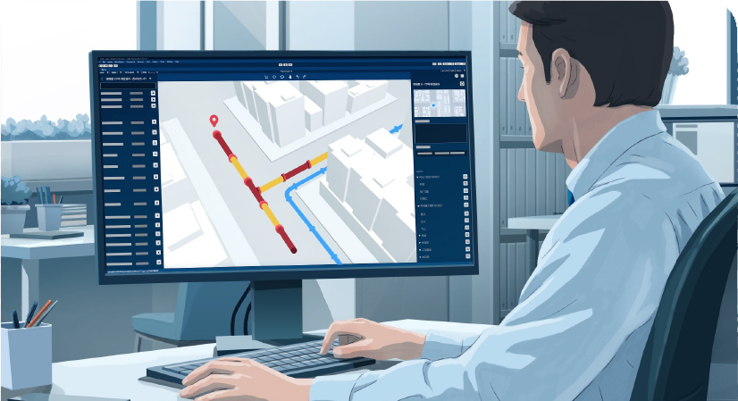
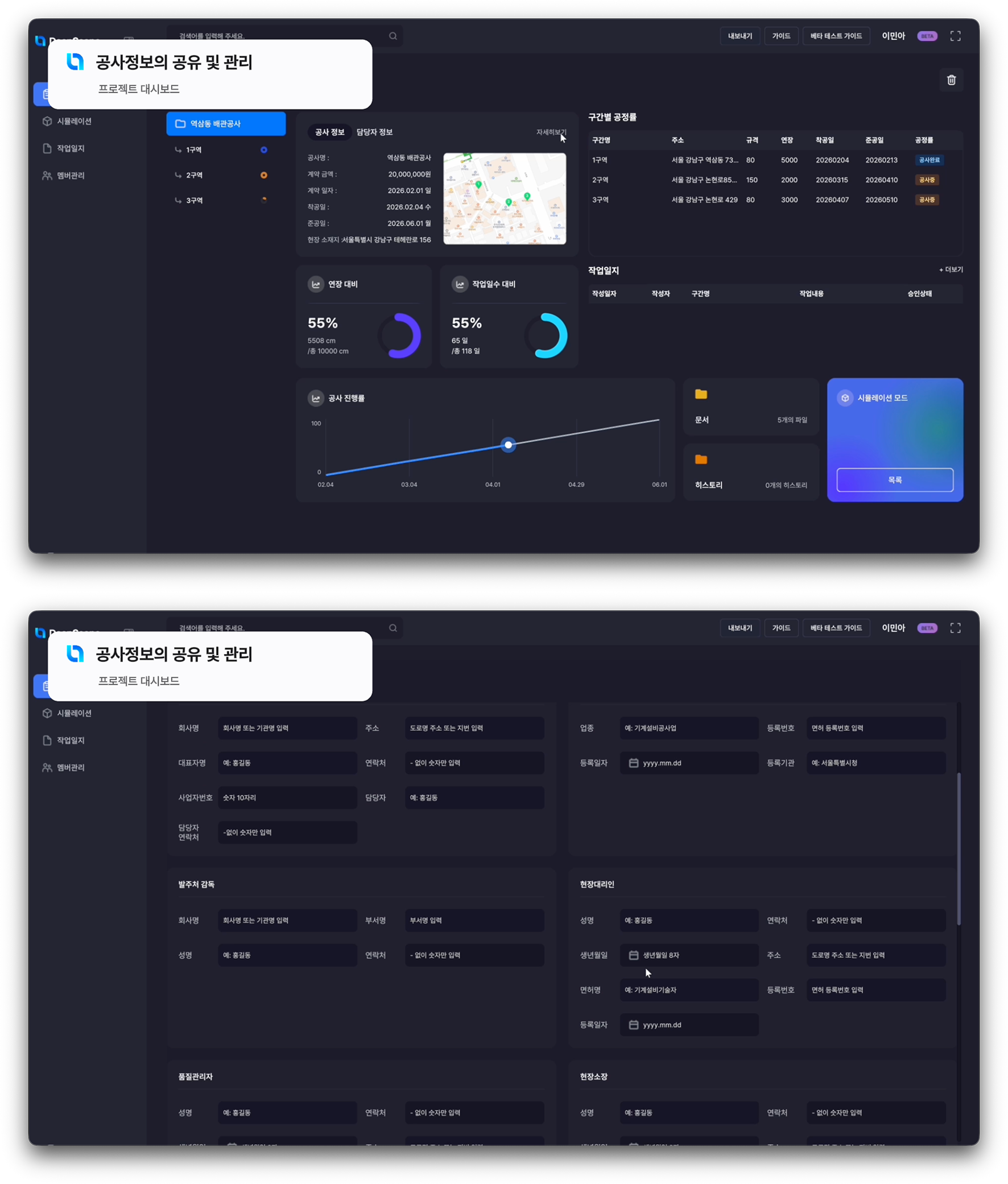
A single workspace for the entire project lifecycle. Manage every construction zone, monitor progress, and run simulations — without leaving the platform.
Cost overruns and schedule slips don't come from a single field issue. They come from a structural management gap: project data is never treated as one continuous flow.
Existing records of underground utilities are often outdated or incomplete, leading to surprises during excavation.
Pre-construction plans drift from on-site reality. Unexpected obstructions force rerouting and stoppages.
Conventional underground surveys are limited in accuracy and coverage, and remain costly and slow.
Drawings, work logs, and approval flows live in disconnected systems. Information moves slowly between site and office.
Deep Scope is a BIM platform that unifies the design, simulation, scheduling, and as-built data of water-and-sewer construction into a single workflow. Terrain-based 3D design, underground-utility interference checking, quantity takeoff, scheduling, collaboration. AI-assisted design cuts design time in half and reduces construction cost by 5–10%, at roughly 30% of the price of legacy BIM tools.
Coordinate system, units, CAD/GIS background.
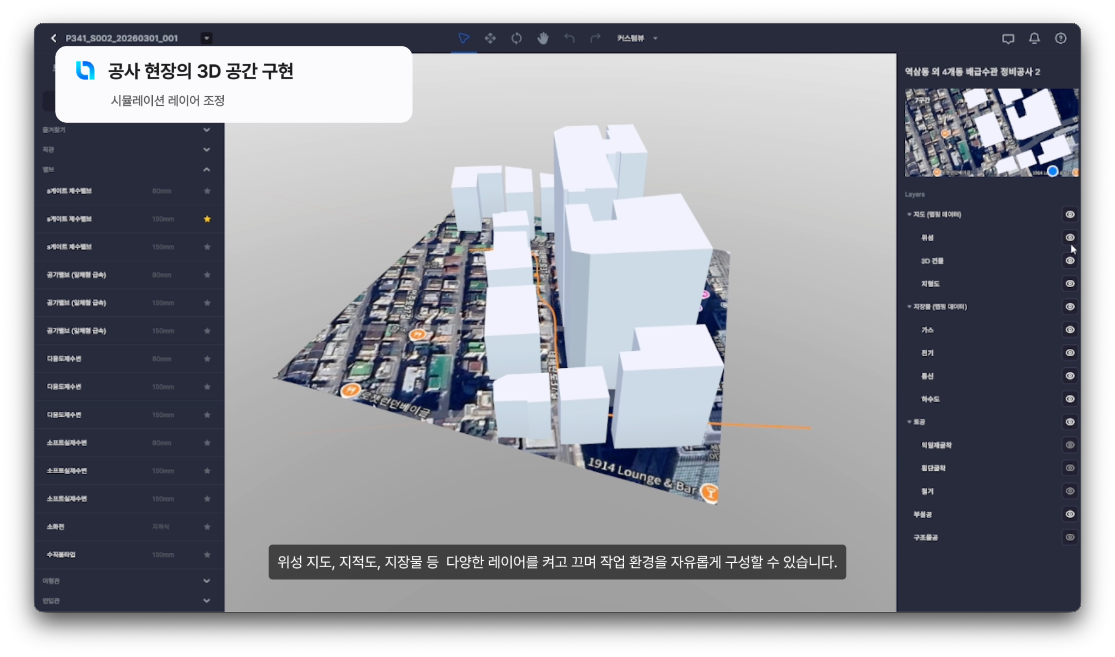
Terrain, buildings, underground utilities.
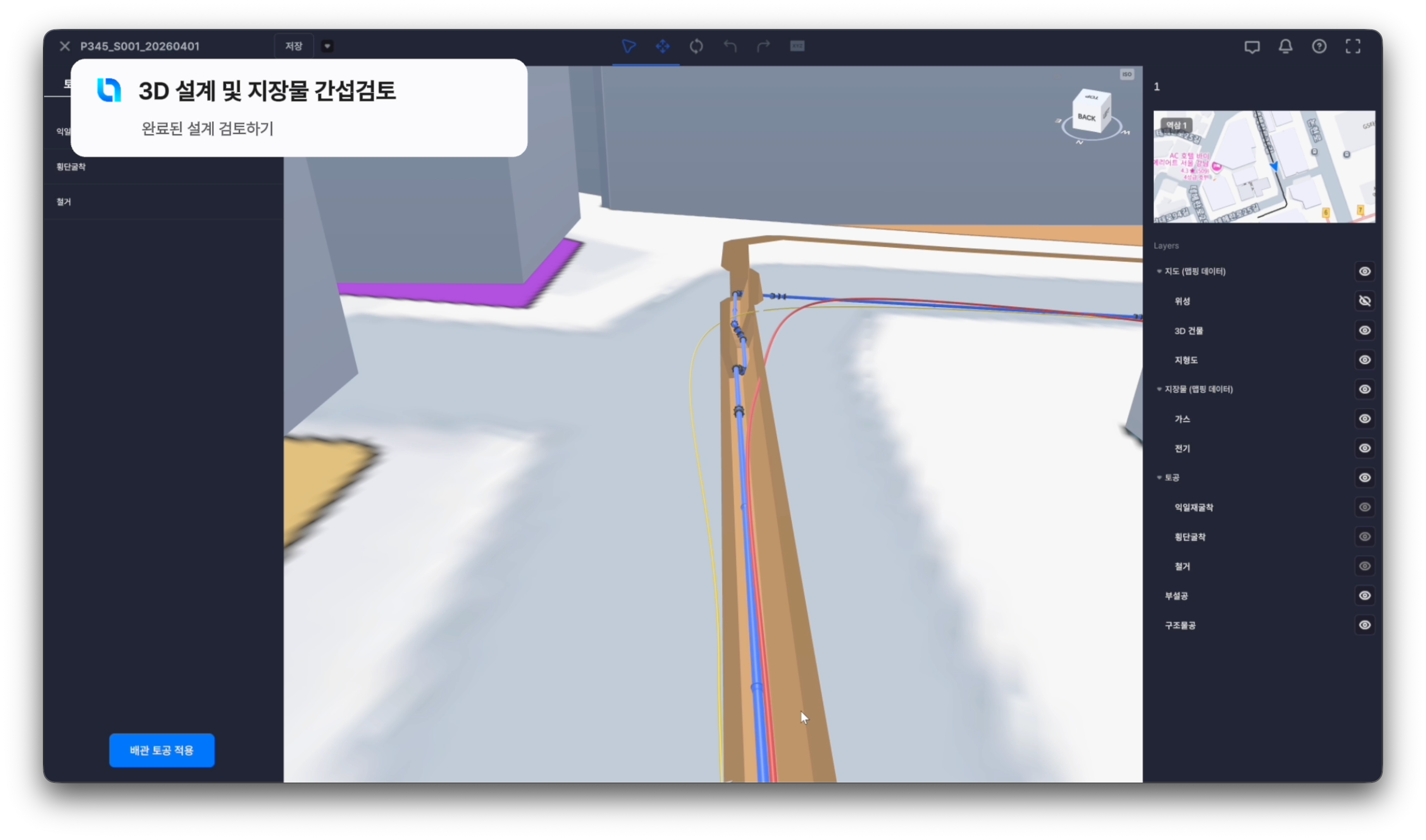
Pipes, manholes, fittings. Interference checks.
Auto-generated plans, sections, reports.
IFC export, dashboards, work logs, approval.
Unify topography, building data, underground utility GIS, and GPR survey results into a single 3D environment. Plan with full underground awareness, before any digging starts.
Parametric 3D pipeline modeling with automatic interference detection against existing utilities. Catch conflicts on the screen — not in the trench.
Auto-generate earthwork, laying, and structural quantities directly from the model. Plans, sections, and reports update the moment the model changes.

Work logs, on-site photos, progress tracking, approval flow — all in one platform. Site and office stay in sync, in real time.
Standardized as-built data, ready to feed municipal GIS systems (S-MAP, etc.) for ongoing maintenance and future projects. Construction data becomes city infrastructure data.

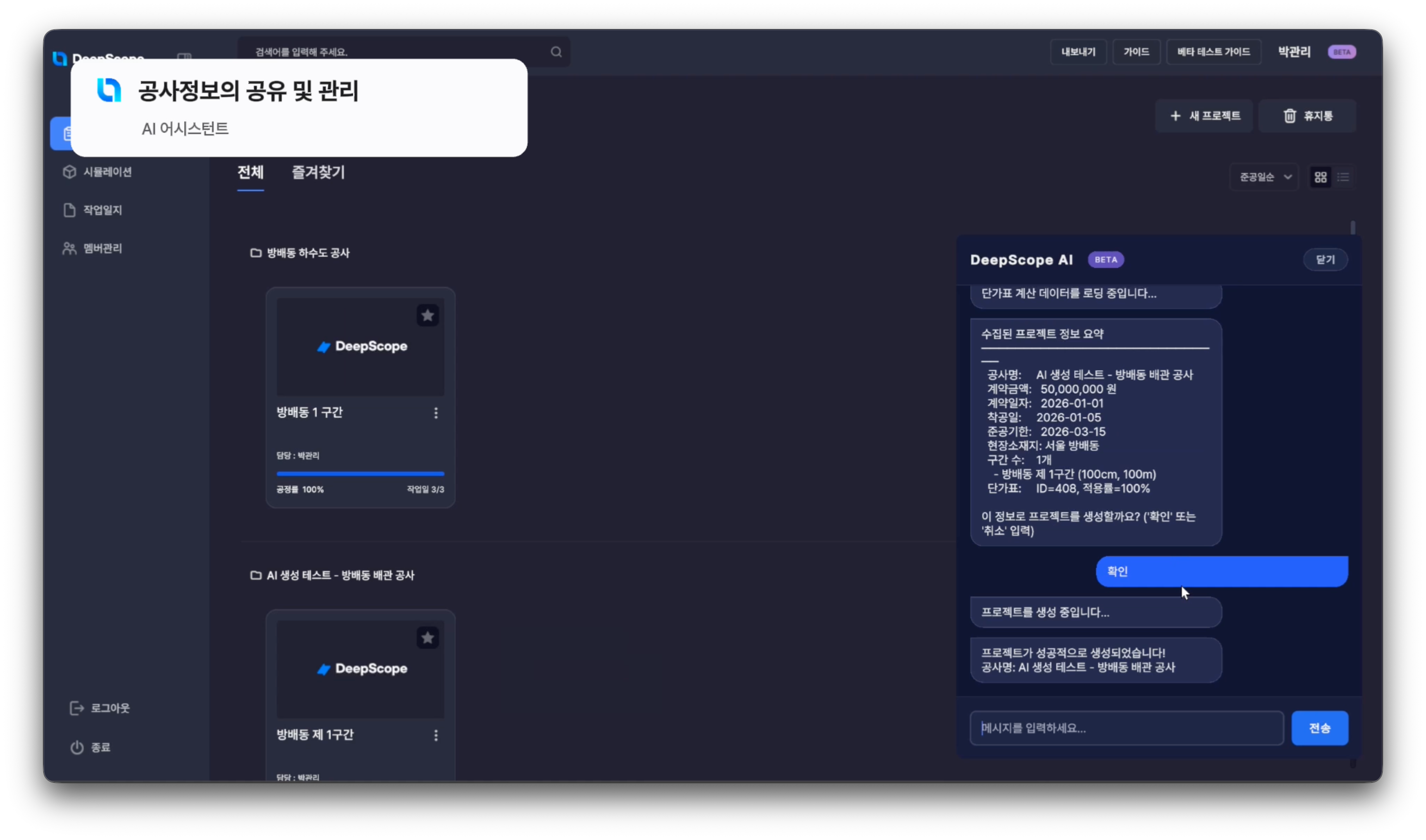
A natural-language assistant for design standards, construction codes, and project setup. Lowers the barrier so non-specialists can design with confidence.
| Stage | Legacy CAD / GIS | Deep Scope |
|---|---|---|
| Design tools | AutoCAD 2D drawings + separate GIS | Parametric 3D pipeline modeling |
| Hydraulic calculation | Outsourced or manual Excel | Built-in calculation engine, auto-linked |
| Quantity takeoff | Manual aggregation from drawings | Model-based, automatic |
| Drawing generation | Manually drafted in CAD | Auto-generated from the 3D model |
| Data format | DWG, PDF (information disconnected) | IFC / openBIM (continuous attributes) |
| Collaboration | File handoff, version chaos | Cloud-based, real-time shared model |
| Underground integration | Lookup in a separate system | Direct GIS / underground-map link |